2025 Family Cemetery Crawl Revision 2

Revision 2

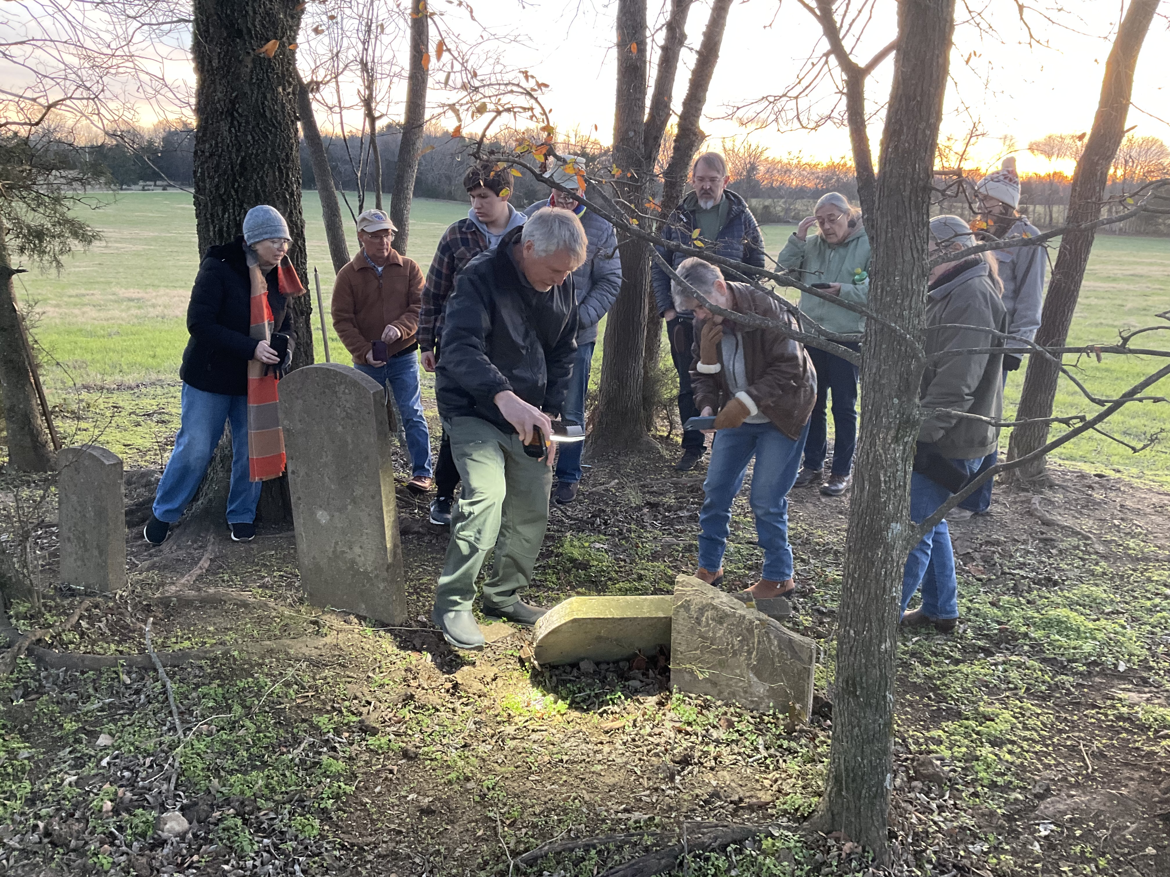
November 29th sixteen distant cousins from Wilson, Rutherford, Dekalb Counties, Tennessee, St. Louis and Kansas City, Missouri and Cincinnati, Ohio, visited six family cemeteries in Wilson County. One near Greenvale,  three near Norene (formerly Henderson Crossroads) and three close to Watertown. The main connection to our group of men, women and teenagers were the Hendersons, Phillips, Bass and Williams families.

Judge Harry Phillips, author of the 1935 Phillips Family History, was discussed (his burial is in Lebanon). We visited his family home in Watertown at 704 Main Street. Harry Phillips was appointed Senior Judge to the 6th Circuit Court of appeals by President John F. Kennedy. Ironically, his successor was our next door neighbor William E. Miller.

Notable ancestors (direct descendants) include Shelah Waters Sr., and his son abolitionist Wilson  Waters, Watertown’s namesake. The family also sent at least 31 soldiers to the American Civil War.

The first stop was the Williams-Warren cemetery on Greenvale Road. Julius Williams has a connection to President Andrew Jackson. Records indicate that “Old Hickory” raced horses on a Williams race track in a field still visible across the road from the Williams cemetery on the Cainsville Road, north of the Simmons Bluff Road (on map above).

Sarah Bass Henderson

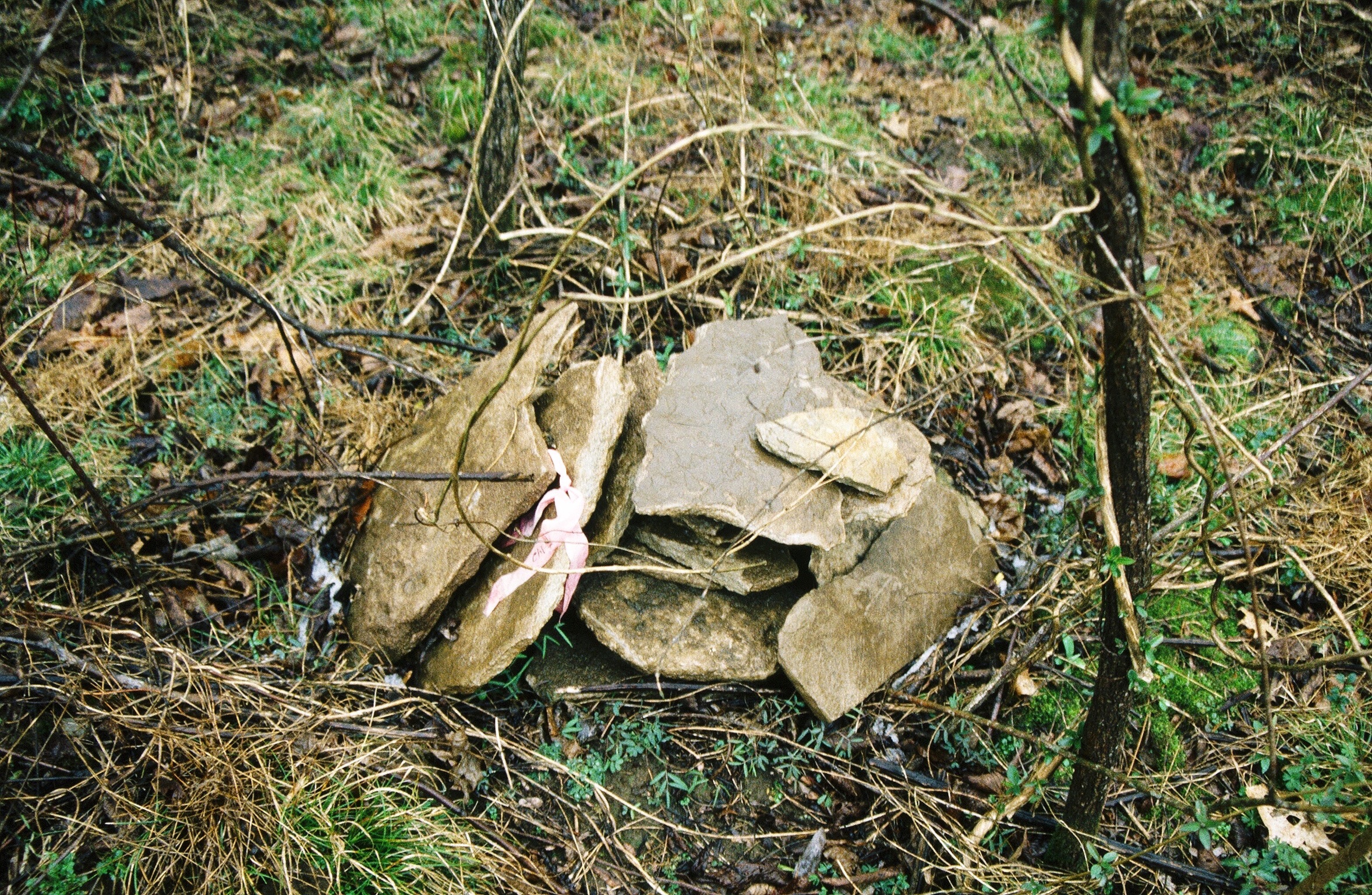
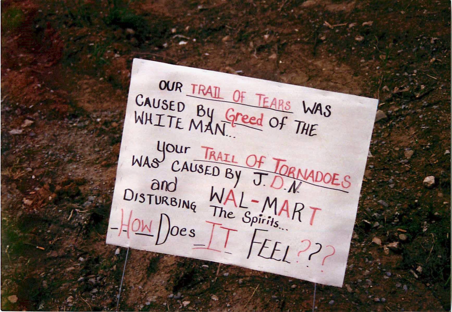
Stop #2: included Sarah Jane Bass Henderson, a direct descendant of an American Indian Nansemond “King” from the Jamestown, Virginia area. She is buried in the Preston Henderson Cemetery on Puckett Road. The cemetery was recently fenced in to prevent livestock toppling the headstones. This is a big problem with several of the other sites we went to. State law requires property owners to install protection from livestock of these sites, but very few do.

Bass American Nansemond Indian History

Preston Henderson

Stop #3: the Cumming-Phillips Cemetery in Norene on Phillips Lane included Harry Phillips grandfather Thomas Phillips. On Cherry Hill Lane we stoped to see the graves of Reverend John Phillips and his wife Rebecca Williams Phillips.

David Phillips Cemetery

Stop #4: David Phillips (War of 1812) and his son 2nd Lt. David L. Phillips (7th TN Infantry CSA) that fought most of Robert E. Lee’s battles, including Pickets Charge at Gettysburg. In the Phillips family history book, there are 25 CSA Civil War soldiers from Watertown. There are at least six that sided with the Union. Three United States Colored Troops (USCT) are buried at stop #4 close to Lt. Phillips.

David Scott, grandson of Judge Harry Phillips

40th USCT Soldiers

2nd Lt. David L. Phillips

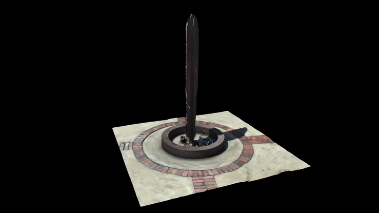
Stop #5: Phillips-Oakley Cemetery on Hale Road. John Phillips  and his brother Benjamin, were the first Phillips in Watertown. Hale Road was the site of a two story log cabin built circa 1797. The cabin was disassembled by family members a few years ago, for reconstruction later. A 3D model was made based on imagery and measurements available to see here:

3D Model of 1797 John Phillips Home

Locals say that General George Patton selected the World War II practice maneuvers in Middle Tennessee because of some of his family in Watertown near our old home place. After a visit to his kin, he decided that Wilson County and the surrounding area, resembled the heart of Germany, and would be perfect for practicing an invasion. The Cecil Patton family owned that land (Hale Road) during that time period. Further investigation is needed to confirm this.

Stop #6: was Shelah Waters, Sr. cemetery. His grandsons were discussed: Union Majors Thomas and Shelah Waters 5th TN Cavalry US. They are both buried in the Nashville National Cemetery. After the war Shelah Waters, Esq. was a U.S. distillery revenue agent based in McMinnville. In 1868, he explored the Higgenbotham Cave (Cumberland Caverns). His name is visible today, written on the ceiling, probably with a carbide lamp. He was appointed to by President Andrew Johnson to be ambassador to Ecuador (this was never confirmed by congress). He went on to be the Postmaster of Lebanon (appointed by President Grant in 1875).

Cumberland Caverns

1437 Cumberland Caverns Rd, McMinnville, TN 37110

Shelah Waters, Sr. Cemetery

Nashville National Cemetery

Union Majors Shelah and Thomas Waters 5th TN Cavalry US

Formerly on Display at the Tennessee State Museum 1

Southeast Wilson County had a large number of Union sympathizers, compared with the rest of the county. In our clan alone there were at least eight. Albert H. Ashworth is buried in the Preston Henderson cemetery along with three Henderson brothers that rode with Forest’s Cavalry.

Albert was with the Union 4th TN Mounted Infantry, the same unit that my second great grandfather did on the other side of my family (James J. Maxwell). When James’s grandchildren asked why he fought for the Yankee’s, he had an interesting response. His (my) ancestors, father James and so William Maxwell were part of the pivotal battle of Kings Mountain in the Revolutionary War.

Two of the Union Soldiers below had brothers that fought for the CSA: Bass and Phillips

Union Family Soldiers

Albert H. Ashworth – 4th US Mounted Infantry Co. H
Ezekiel W. Bass – Captain – 5th TN Cavalry
John Berry
George Oakley – 4th US Mounted Infantry Co. H
James Oakley Captain – 4th US Mounted Infantry Co. H & 5th TN Cavalry Co. B KIA Petersburg, VA
John Wilson Phillips – Lt. Col. 18th Pennsylvania Cavalry Co. B (wounded at Gettysburg)
Shelah Waters – Major – 5th TN Cavalry
Thomas Waters – Major – 5th TN Cavalry

Confederate Family Soldiers

Smith AllenKIA Franklin, TN
Elias Benjamin Bass
Thomas BassKIA d.1865
John L. Bassb. 1834
John Wiseman Bass CaptaincapturedCivil War & Mexican War
William Emsley Bass
Petter DonnellForrest 4th TN Cavalry Co. C
William Evans
David Wilson Grandstaff 1st Lt./Capt.Forrest 4th TN Cavalry Co. Ccaptured
John Bethel Grandstaff
Isaac Preston Grandstaff
Samuel Archibald GrandstaffKIA Stones River 11/30/1862
William Dillard Grandstaff Col. Erastus Smith
Samuel B. LambertPatton’s Co. Anderson’s Reg.
Benjamin Phillips
David L. Phillips 2nd Lt.7th TN InfantryUnion University
James Madison Phillips – MajorForrest 4th TN Cavalry Co. CUnion University
Joshua Phillipswounded at Shiloh lost one eye,farm ransacked by Union
John Phillipsb. 1837
Matt Phillips
Sion B. Phillipsb.1833
Thomas Phillipsb. 1844
William PhillipsForest Cav. Shot off horse at Stones Riverb. 1839
William Preston PhillipsForrest Cavalryb. 1825
Edward Price
Mitchell Hall TompsonDied in Federal Prison 11/13/1863B, 1841

2025 Necropolis Guard Team Members

Another Phillips legend was at the Normandy invasion in WWII. Ed Phillips and Bill Allen have a great story on Nova PBS. The heroic Navy Corpsmen made four runs onto the beach, including the first wave.

  1. The Tennessee State Museum moved in 2018 and downsized much of its American Civil War displays. There is a new military museum in production, that hopefully will include some of these artifacts.

Brown’s Diner Part II

Car #2 Revealed

Last week 90% of historic Brown’s Diner Street Car #2 was demolished to make way for a larger diner kitchen. I observed the entire project and salvaged what I could, but very little of the original car was left, probably due to decades of updates, and at least two fires. They were fortunate that Ladder 16 was across the street for most, if not all of their 96 year old history.

The 4″x4″‘s underneath the floor were severely charred (I have several in my possession). Leaking grease from the grill is probably the accelerant for the fire below. I believe these are part of the original car, but what I found attached to them underneath, is another mystery.

Both cars have chassis that are clearly not from any known street cars, even mule drawn. A local expert surmises that the massive original Street Car iron wheels were salvaged and these were used to move the cars to their final resting place at Brown’s in 1927. The Car #1 wheels closely resemble those I found at the Ellington Agricultural Museum on farm equipment. The Car #2 wheels and chassis look very similar to old Circus Wagons. I would date both car chassis at around 150 years old.

Here is a 3D model of the documented components of Car #2. Note the pivot rings on the front end of the car. The video below illustrates their function.

This 3D image shows the remains of Car #2, about 7 feet of the original car length. The wheels and chassis are under the framing.

Nashville Inter Urban Railway

note: the term Trolley Car was never used for these vehicles

More on Nashville Street Car history

Brown’s Diner Part I

#streetcars

Nashville Street Cars

Brown’s Diner Investigation

Most people call it a Trolley Car, but the actual terminology in “the day” was Road Railway or Street Car. Shortly after the American Civil War in 1866, Memphis and Nashville adopted these public road transportation vehicles. Initially they were horse and mule drawn vehicles. Then they were powered by small locomotives called dummy railroads, and around 1889 they began the conversion to electric power.

In 1927 Brown’s Diner was opened using two former street cars as the restaurant in the form of a “T”. Brown’s is the second oldest restaurant in Nashville and holds the oldest beer permit: #0007.

From the recent renovation, these images suggest that Brown’s Diner’s cars may have been powered by mules or horses. But the wheels don’t match the car, and the 38 foot car is too large to be animal powered. One expert thinks these wheels are not original to the car and were only used to move it from the rail line to its current location. Car #1 which is perpendicular to Blair Blvd, and has two blocks of wheel trucks intact which have flat iron wheels 26 inches in diameter. They are not cast-iron like typical street cars. They also lack the sprung and equalized mechanism (suspension system) designed into a four-wheel truck system.

These iron spoked wheels resemble ones I observed the other day at the Tennessee Agricultural Museum at the Ellington Center, mostly used on 19th century farm equipment.

Axle assembly 16 feet from the west end of the car.

How the cars got to this location is speculative, but about 6 months before Brown’s opened in 1927, Nashville hosted the “Parade of Road Railways”, which is featured in Ralcon Wagners book Nashville’s Streetcars and Interurban Railways. Brown’s Diner is located at the terminus of the Nashville Street Railways line at Blair Boulevard and 21st Avenue.

Road and Road Railway Map

The rafters of Car #1 are covered back up with insulation, but here is what it looks like above the new ceiling:

21 rafters spaced about 21 inches apart, except for the ones next to the flue.

Car #1 measures 38 feet long in the interior, 8 feet wide and 7.5 feet tall. Two sets of wheel assemblies are located 41″ from the south end of the original car, and 16 feet from the west end of the car. They certainly had more wheels than just four to move the car. Probably eight wheels on two four set groups.

View 3D Wheel

Car #2 is yet to be examined, but one wheel was discovered near the intersection of Car #1. The mystery is the origin of that car because the wheel does not match any know street cars. It’s more like a wagon wheel consisting of wooden spokes and rim. It measures 32 inches in diameter.

Car #2 is either not a street car, or modified with these wheels to roll it into place. Examination will continue during the second phase of the renovation to begin sometime later this year.

From what has been examined so far, this 3D model represents the known structural elements of Car #1. I will make updates to it as more information is discovered.

View 3D Model of Car #1

Most desirable, are any pictures of Browns Diner before 1982 when the main dining area was added. Please leave a comment if you have anything to add.

This is the oldest known picture of Brown’s, probably from the 1940’s.

Brown’s Diner circa 1940’s

Address: 2102 Blair Blvd, Nashville, TN 37212

https://www.thebrownsdiner.com

https://www.facebook.com/brownsdinernashville/

Brown’s Diner Part II

A Virtual Native Village

My moments of stupidity are well documented, but my strokes of genius may have been under reported…

I was going round and round about the best use of the long abandoned playing field at Brookmeade Park in West Nashville: open space, dog park, soccer field? Native American Living History Village!? After all, it was the site of one of the largest archeological digs in Middle Tennessee.1 Artifacts were dated back to the Paleo-Indian period after the last ice-age. The Woodlands and Mississippian graves revealed an amazing amount of information about the tribes health, diet and mortality.

First of all, I don’t think the general public cares (or is even aware of) the indigenous people we all but wiped off the face of this country. All the more reason to tell the story and pay homage to them here: in a wooded area, on the edge of the capitol city of the state of Tennessee (Cherokee for Tanasi).

Practically speaking, a Living History Village would be expensive to build, and even more challenging to maintain and protect, especially at this location. Vandalism would be expected from the get-go.

Enter A/R. Augmented Reality is in insanely inexpensive compared to brick and mortar construction. In this case, the imagery is readily at hand.2 All the user needs is a smart phone, tablet or special glasses. Scan a QR Code and Bingo! Augmented Reality 3D imagery appears right before your peepers. And best of all, its bullet proof from vandals.

Check out this model in 3D and virtual reality on Sketchfab:

Brookmeade Park Greenway at Kelley’s Point by belmontguy

A/R Image Displayed on iPhone 13

American Battlefield Trust Tours:

Native American Monument at Fort Nashborough

Footnotes

  1. https://bnabucketlist.com/2022/01/31/native-american-graves-shrugged/↩︎
  2. Pro Bono construction by Bob Henderson. Nominal hosting service fees.↩︎

Native American Graves Shrugged

In 1997 I started documenting the development of the new mega shopping center near Charlotte Pike and Davidson Drive in West Nashville. The limestone rocks photographed here, were just some of the components of 141 Native-American Stone Box graves containing 173 individuals discovered during the excavation. Artifacts recovered date back as far as the Paleoindian Period (12,000-10,000 BC).

The remains were warehoused for a period of time, and then reinterred at an undisclosed location in Brookmeade Park at Kelley’s Point Battlefield. They are more than likely being camped on, and fowled by, human waste and garbage today. This is a shameful despicable desecration of indigenous people.

“The greatest distinction within the data set explored here is the Kelley’s Battery site (40DV392) and the two excavated cemeteries (Figure 8). A total of 141 burials yielded the remains of 173 individuals at the Kelley’s Battery site.” 1

“The Kelley’s Battery site (40DV392) is a multi-component prehistoric site located on the Cumberland River in western Davidson County, Tennessee. Salvage excavations were conducted in 1998 prior to destruction of the site by development. Evidence of Paleoindian through Mississippian period occupations was recovered. Of particular interest is the excavation of two Mississippian stone-box cemeteries and associated village. An overview of the excavation is presented along with investigation results. A single radiocarbon date of 670+60 B.P. with a single-sigma calibrated range of AD 1282-1390 was obtained for the Mississippian occupation. The excavation and analysis results determined the Mississippian occupation of Kelley’s Battery comprised a nucleated village primarily occupied during the period of regional decentralization (AD 1325-1425).” 1

Stonebox Graves

“Mississippian Indians in Middle Tennessee usually lined their burials with large limestone slabs. They placed slabs on each side, and at the head and foot of the grave, carefully cutting and joining them. The body was placed in the stone coffin face up and fully extended. A stone slab was used as a cover, and a layer of earth, from a few inches to a few feet deep, was spread over the top. This type of burial is called a stone-box grave. Mississippian people in other areas of the Southeast also used this method when easily worked stone was available.” 2

The siege of the park by homeless started around 2018 and exploded in 2020. The city of Nashville has yet to enforce a variety of laws being violated in the city park including camping, open fires, littering, loitering, defecating, drug use and more. The Metro Greenway has been deemed unusable and unsafe. Crime in the area has risen around the camp. At least 8 individuals have lost their lives to overdoses in the last 2 years. Neighbors surrounding the park are pushing hard for their removal and relocation to subsidized housing and/or treatment for a variety of addiction’s and mental illnesses. reclaimbrookmeadepark.com is a grass roots group spear-heading this effort.

Additionally, the park is the site of a historic naval action, preceding the Battle of Nashville. For two weeks in December 1864, the Confederate Cavalry clashed with a half-dozen US Navy gunboats here. This was the last major offensive champaign of the American Civil War by the South and one of the largest of its kind.

August 2021 at Kelly’s Point at Brookmeade Park – photo by Bill Brewer

A New Park

One of the reasons Brookmeade Park was a magnet for a homeless camp was it’s under utilization. Most people in the area never knew it was there because it is hidden from view under the immense amount of invasive plant undergrowth.3

As soon as the residents of this park are relocated to suitable living conditions, a plan needs to be in place to ensure the parks activity with the local population. There are a variety of possible options for this 14 acre scenic parcel of river-front property. Suggestions include:

  • Soccer Field
  • Native American Living History Village (virtual reality option)
  • Dog Park
  • Invasive Plant Removal and Native Hardwood Tree Planting
  • U.S. “Brown-water” Navy Memorial (virtual reality option)
  • Expansion of the Greenway across the river to Bell’s Bend Park

See a 3D visualization of what this park could look like here.


  1. Interpretation of the Structure and Variation of Middle Cumberland Mississippian Stone-Box Cemeteries (40DV392) – J. Scott Jones↩︎
  2. http://www.nativehistoryassociation.org/noelcemetery.php↩︎
  3. https://www.weedwrangle.org↩︎

#nativehistory #brookmeadepark #nhaorg

Log Cabin Shrugged

220 Year Old Homestead

John Phillips

1768-1846

Founding Father of Round Lick, Tennessee

2016

In 17971 brothers John (29) and Benjamin Phillips (31) migrated from western Pennsylvania to what was then called Round Lick in Wilson County, Tennessee. It was renamed Watertown in the mid-1800’s in honor of Wilson T. Waters, the grandson of one of it’s founders.

In 2021 one of the oldest Middle Tennessee frontier log cabins was removed from its 220 year old site. It may have been the oldest two-story log cabin in Wilson County. Parts of it were salvaged by a family descendant that hopes to one day restore a one-story version of the Phillips family homestead. A digital  reconstruction of the original cabin can be viewed here. Images of the second floor in 2016 can be viewed here.

2016

“Dr. J. M. Phillips, in an article on the Phillips family in the Watertown Sentinel, January  19, 1906, state: that the brothers and their families em-barked southward on a flat-boat on the Ohio River at Pittsburg, thence down the Ohio to the mouth of the Cumberland; that they disembarked there and struck out across the wilderness of Kentucky and Tennessee in wagons until they reached the headwaters of the Round Lick Creek at the present site of Watertown. The settlers followed the West fork of the creek until they came to a big spring in the canebrake, and it was there that they made their final halt. John Philips built his home only a short distance from the spring.” 2

Spring

On December 20, 1801, William Phillips sold 200 acres to John Phillips far $400 in cash. “Beginning at a hackberry on Lytle’s 2.5 west boundary, six poles 3 [33 yards] north of the creek running thence west one hundred and forty-nine poles [820 yards] and three-fourths to a stake; thence south two hundred and nineteen [1205 yards] and a half poles to a stake; thence east one hundred and forty-nine [820 yards] and three-fourths poles to three lynns; thence to the beginning; the whole containing two hundred acres be the same more or less with all its appurtenances.” 4

In the preceding years, John’s land increased to 365 acres. “The Wilson County Court Records of 1803 show that John Philips owned 200 acres of land on the Round Lick Creek and Benjamin 120 on Round Lick and 100 on the Hickman Creek. Both brothers acquired more land as they prospered. John bought fourteen acres from William Philips (of Davidson county) for $40 cash on December 14, 1808; ninety-five acres from William Campbell, for $750 cash on September 27, 1819; 21 acres from Richard Cartwright for $78 cash on December 10, 1829; and 35 acres from Joseph Philips for $350 cash. Both John and Benjamin received grants from the State of Tennessee, John’s on July 20, 1813, and Benjamin’s on May 24,1814. Both grants were signed by Willie Blount, governor.”5

John was a respected member of the community, but did not unite with any church, although his wife Mary was a member of the Baptist church. They had 11 children; six sons and five daughters. All eleven lived to raise families of their own.

“John Philips died July 30, 1846, at the age of 78; his wife, Mary pre-deceased him on November 20,1844, aged 71. Benjamin died only 28 days before his brother, on July 2,1846. Lydia Philips died August 19, 1851. The report of Sion Bass, administrator of Benjamin’s estate, was confirmed by the County Court December 14, 1848.

David Phillips, son of John, was appointed administrator of his father’s estate. However, David died September 30, 1846, only two months after John’s death, before he had completed his administrative duties. Rev. Henry Bass, who married John’s daughter, Francina, was appointed administrator de bonis non, and proceeded to wind up the estate.

John Philips accumulated more than a modest amount of wealth for a farmer of his day. When he died, he owned 350 acres of fertile land, and possessed $1,436.75 in gold and silver, $40 in bank notes and about three dozen promissory notes of various amounts. After the payment of all debts, his personal estate totaled $7,039.69. Each of his ten distributees received $703.96 and thirty-five acres of land.

Among the expenses itemized were: $1.00 to Doke Young for crying sale and $6.00 to W. L. Waters for coffin. The total funeral expenses, including clothing, were $15.75. A tomb stone was erected many years later.

The list of articles itemized among  John Philips’ personal property gives the reader a conception of the self-sufficiency of the pioneer home. Among the articles listed were the following: One yoke of oxen [2], 38 hogs, 36 geese, 548 pounds of bacon, 163 barrels of corn, 4,480 bundles of oats, 3,000 pounds of fodder, 1,910 pounds of pork, 12 plows, 3 singletrees, 1 doubletree, 1 wagon, 1 cart, 36 bushels of wheat, 3 washing tubs, 1 brass kettle, 2 teakettles, 2 fat skillets, 5 pots, 2 fire shovels, 2 cotton wheels, 2 wooden buckets, 4 bedsteads,140 pounds of seed cotton, 1 cross-cut saw, 2 coffee mills, 1 deer skin, 1 wash pan, 1 frying pan, 3 bread trays, 1 candle stick, 2 shot guns, 2 rifles, 1 candle stand, 1 handsaw, 2 clocks, 1 pair of sheep shears, 3 pecks of dried apples, 4 bee hives, 3 pairs of weavers looms, 4 bee gums, 7 saddles, 2 sickles, 1 umbrella, 17 ducks, 100 chickens, 13 bushels of Irish potatoes, 2 pickling stands, 1 grindstone, 1 work bench, 814 pounds of picked cotton, 67 pounds of lard, 19 horses, 39 sheep, 18 cattle, and dozens of other items.

There is a two-year discrepancy in the records as to the date of John Philips’ birth. The family Bible of his son, Benjamin, gives it as April 16, 1768. His tombstone records that he was in his eighty-first year when he died in 1846, which would place his birth in the year 1766. Since the Bible gives Benjamin’s birth as April 18, 1766, and was a contemporaneous record, while the tombstone was erected many years after John’s death, the author is inclined to accept the date given in the Bible.

Benjamin Philips’ estate was wound up in 1848. His coffin, too, was bought from W. L. Waters for $6.00. Among the interesting items of his settlement was an allotment of $26.90 to his widow, Lydia Philips, for a year’s support.

The brothers and their wives are buried on a little knoll which was formerly a part of John Philips’ farm, only a short distance southwest of Watertown. A handsome tombrock marks John’s grave, bearing this inscription: “John Philips died July 30, 1846, in the 81st year of his age.Mr. Philips was one of the first settlers on Round Lick, being the father of six sons and five daughters.”  6

Click below to see the 3D model:

https://sketchfab.com/models/327ec6dfe049467695928bb98d4e621c/embed


  • 1. Phillips Family History – p. 10  Harry Phillips 1935↩︎
  • 2. Phillips Family History – p. 10  Harry Phillips 1935↩︎
  • 2.5 “The area around Watertown was first settled by Captain William Thompson of North Carolina in 1780. He built a fort in the area to protect settlers and provide a safe haven for travelers on the nearby Holstein Trail. After Thompson left, the land became a revolutionary war grant given to Colonel Archibald Lytle, who received 1,000 acres, and his brother, Captain William Lytle, who received 500 acres.” – – https://watertowntn.com/about/history/↩︎
  • 3. a pole is 5.5 yards↩︎
  • 4. Phillips Family History – Harry Phillips 1935↩︎
  • 5. Phillips Family History – p. 14 Harry Phillips 1935↩︎
  • 6. Phillips Family History – p. 16 Harry Phillips 1935↩︎

Family Cemetery Tour 2017:

Tour 11 family cemeteries from Walter Hill to Watertown:

Watch some of the tour we did yesterday to raise public and private awareness of the need to protect family cemeteries in Rutherford and Wilson County, Tennessee.

Stop #1 –  Hoover Cemetery – Water Hill, Tennessee

Stop #2 – Malone-Henderson Cemetery – Powell’s Chapel Road

Stop #3 – The Old Homeplace – Powell’s Chapel Road

See a 360 virtual tour here.

Stop #4 – Charlton Ford Cemetery – Dinky Lane

Stops #5 & #6 – Patrick and William Short Cemeteries – Powell’s Chapel Road and Mona Road

Stops #7 & #8 – Williams Cemetery (Cainesville Road) and Preston Henderson Cemetery (Puckett Road)

Stops #9, 10 & 11 – John Phillips Log Cabin, John Phillips Cemetery (Hale Road) and David Phillips Cemetery (Bass Road) – Watertown, Tennessee

See more virtual tours here.

Family members: I am researching 2nd Lt. George Malone of the 18th Tennessee. I will look for his grave in Atlanta this month when I’m down there. My guess is that he was killed in the Battle of Kennesaw Mountain. His regiment was at the Dead Angle, ironically right next to my GGF 2nd Lt. Walter Scott Bearden of the 41st Tennessee. Additionally, their General Joseph B. Palmer was wounded a few days later in the Battle of Jonesboro where my GGF was severely wounded too during the last fight of the Battles of Atlanta.

A ride in the country

Rutherford and Wilson County Family Cemeteries:

“We all feel our fathers could not have chosen better women for our mothers than they did, could they have had all the advantages of our modern household arrangements.”…
“I have seen much of the world since I left you seventeen years ago [1862*]. I have lived in five different states of the Union, and visited many more, and know the average standard of morals and of the public conscience in a great many large communities, but I have never yet found the community so nearly free from moral defilement, and with so high an average of moral worth and so high a standard of duty, where manhood and womanhood have fewer stains upon them, than right here in Wilson County, within a circle of five miles from this point as a center.”
– Rev. David Waters – 1879
Watertown, Tennessee

Caravan tour of cemeteries and home sites of the ancestors of Tab and Hattie Henderson: Phillips, Waters, Cummings, Bass, Malone, OakleyPeyton, Short, Williams and more.

Friday, November 24, 2017 • The day after Thanksgiving
Organizers:

• Billy Pittard: (310) 880-7276

• Bob Henderson: (615) 477-0737

9:00 AM – Meet at Walterhill Church of Christ 7277 Lebanon Rd, Murfreesboro, TN 37129 The church is about a mile north of the intersection of Lebanon Road (US 231) and Jefferson Pike. 9:15 – Caravan hits the road!

https://www.google.com/maps/d/embed?mid=18OprmbUtUJSt5YXQPq-ZhlT-ewLcFPv-

*in 1862 David Waters two brothers joined the 5th Tennessee Union Cavalry. Their father Wilson Turner Waters was a staunch Unionist.
#savingcemeteries

Battle for the Battlefield

Imminent Development of Fort Negley Park:

The Old Greer Stadium – Vote is May 16, 2017 at 6:30PM | Davidson County Courthouse, 1 Public Square, 2nd Floor, Nashville, TN

photo by: Blake Henderson

Besides the tourism/historic value of this American Civil War icon, why is the city wanting to decrease public green space downtown? There is too little of it now. This 16 acre parcel has been in the public park inventory since the 1920’s. Half of it is proposed for commercial development by the Metro Council. That could be 8 acres of public downtown Green Space! As downtown explodes in development, we need more, not less, open space!

Key Points

  • Fort Negley is the largest Civil War stone fort (inland)
  • Few Civil War sites remain in Nashville
  • African American Contraband Camps were located here
  • A former cemetery of over 11,000 Union soldiers – some of which could still be there
  • Water run-off issues
  • Less green space
  • More trafic congestion
  • Monarch butterfly habitat
  • Rare fossil site

If you live in Davidson County, Tennessee please contact your council person here.

Download the Friends of Fort Negley Plan

@savingplaces #thisplacematters #fortnegley

David Phillips

David Phillips Cemetery:

Bass Road, Cherry Valley, Tennessee (private property)

David Phillips, son of John and Mary Phillips, was born in Washington, County Pennsylvania December 11, 1794. Migrated to Tennessee at the age of three with his parents. He is our 4th American generation (A4) and the second David Phillips of that line.

Married Mary “Polly” Waters December 14th, 1820. She was the daughter of Shelah Waters, whom the city of Watertown is named.

Died: September 30, 1846 buried in the Phillips Cemetery on Hale Road (one of 3).

“David was a soldier in the War of 1812*, family lore says he fought with Gen. Andrew Jackson at New Orleans. The War of 1812’ files in the Tennessee State Library at Nashville show that there were 138 soldiers by the name of Phillips in the war and six of these were named David. One was a corporal under Colonel Benton, one was a corporal under Captain Gibbs, The three were privates under Colonel Lowry, Colonel Coffee and Captain McKee, and one was a drummer under Major Woodfolk.”

‘The Phillips Family History’ by Harry Phillips • Published by The Lebanon Democrat • 1935

Pension records list David as a Private.

david-phillips.JPG

The site of the War of 1812 soldier David Phillips Sr. is located on Bass Road in Watertown, Tennessee. His son Lt. David Phillips (CSA) is also buried there. There are also several U.S.C.T. headstones.

David’s N.S. U.S.D. marker is incorrectly located at his fathers cemetery on Hale Road a few miles away.

360º Virtual Tour

Recommended Reading:

Phillips Family History: A Brief History of the Phillips Family, Beginning with the Emigration From Wales, and a Detailed Genealogy of the Descendants … Pioneer Citizens of Wilson County, Tenn.

#warof1812

*History of Tennessee (1886), page 1112